 The Maya Civilisation
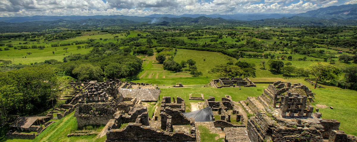
Geography and Landscape
The Maya lived in the area in Central America which now consists of Yucatan, Guatemala, Belize and southern Mexico (the Chiapas and Tabasco provinces). This whole area lies south of the tropic of Cancer, and north of the equator, and is about 900 kilometers from north to south and 550 kilometers in the east-west direction. The topography of the area greatly varied from volcanic mountains, which comprised the highlands in the South, to a porous limestone shelf, known as the Lowlands, in the central and northern regions. The southern portion of the Lowlands were covered by a rain forest with an average height of about 150 feet. Scattered savannas and swamps, or bajos, appeared sporadically, interrupting the dense forests. The northern Lowlands were also comprised of forests but they were drier than their southern counterparts, mainly growing small thorny trees. February to May was the dry season characterized by air that was intensely hot and uncomfortable. At this time of year, the fields had recently been cut and had to be burned in accordance with their slash and burn form of agriculture. The skies filled with a smoky grit, making the air even more unbearable until the rains came in late May to clear the murky atmosphere.
The climate is as varied as the landscape is. In general it is hot and humid, as the area lies in the tropics, and the coast is always near. The rainfall is strongly influenced by the presence of the mountain ranges near the coast, and this creates large differences in rainfall in different parts of the land.
The altitude is the main influence on the temperature; the annual temperature in the lowlands is between 25 and 30 degrees Celsius, in the highland plateaus between 15 and 25 degrees, and in the mountains below 15 degrees.
These external factors lead to a rough division of the Maya land into three areas: The lowland (the arid Yucatan peninsula), the central rain-forest zone, and the southern highlands and Pacific slope.
The rainy season lasts from May to December; in the entire Maya area the relative humidity stays above 80% in this season, in the dry season it drops to about 60%. This seasonality governs the agricultural cycle, and it makes it important for the farmers to time their activities accurately.
Many dangerous animals occupied this region of the peninsula including the jaguar, the caiman (a fierce crocodile), the bull shark, and many species of poisonous snakes. These animals had to be avoided as the Maya scavenged the forest for foods including deer turkey, peccaries, tapirs, rabbits, and large rodents such as the peca and the agouti. Many varieties of monkeys and quetzal also occupied the upper canopy. The climate of the Highlands greatly contrasted with that of the Lowlands as it was much cooler and drier.
Both the Highlands and the Lowlands were important to the presence of trade within the Mayan civilization. The lowlands primarily produced crops which were used for their own personal consumption, the principle cultigen being maize. They also grew squash, beans, chili peppers, amaranth, manioc, cacao, cotton for light cloth, and sisal for heavy cloth and rope.
The volcanic highlands, however, were the source of obsidian, jade, and other precious metals like cinnabar and hematite that the Mayans used to develop a lively trade. Although the lowlands were not the source of any of these commodities, they still played an important role as the origin of the transportation routes. The rainfall was as high as 160 inches per year in the Lowlands and the water that collected drained towards the Caribbean or the Gulf of Mexico in great river systems. These rivers, of which the Usumacinta and the Grijalva were of primary importance, were vital to the civilization as the form of transportation for both people and materials.